
Street plan of Tanis
Infra-red imaging
More than 1,000 tombs and 3,000 ancient settlements were also revealed by looking at infra-red images which show up underground buildings due to the differing densities between the rather dense mud-bricks used in Ancient Egypt in building construction and the typically less dense surrounding sands or soils under which mud brick building foundations may often now lay buried. The cameras on the satellites are so powerful they can spot objects of less than a metre in diameter.
The work has been pioneered at the University of Alabama at Birmingham by US Egyptologist Dr Sarah Parcak.
She says she was amazed at how much she and her team has found.
Thanks to NASA and others we now have an enhanced Space Archaeology satellite imaging technological capability to accurately identify and map buried archaeological settlements, across large areas. Objects or features of less than a metre in size can be discerned.
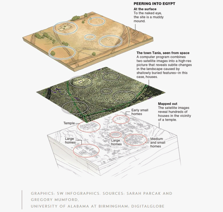
The full extent of the street plan of Tanis, once the capital of ancient Egypt, and a site made famous by the Indiana Jones film Raiders of the Lost Ark, has also been revealed ~ and appears to suggest a scale some four times greater than had previously been imagined.
Thanks to satellite facilitated infra-red imaging techniques Parcak discovered an ancient network of streets and houses at Tanis, which are completely invisible from the ground.
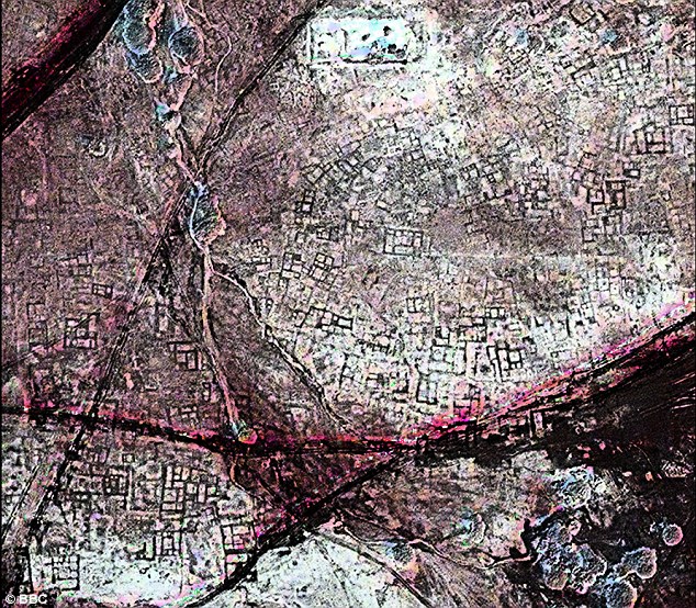
An ancient streetmap: A satellite image shows a once densely occupied city of Tanis to be littered with underground tombs. Buildings in ancient Egypt were constructed out of mud brick - the material is dense, allowing satellites orbiting above Earth to photograph the outlines of structures completely invisible to the human eyes of even trained archaeologists in ground surveys.
The remote-sensing approach seems to ideally involve detection of relatively vigorous or stunted plant-health which is itself closely related to the sub-soil conditions in the terrain upon which vegetation grows.
"When a wall is slowly covered over by earth, the material it's made from decay and become part of the soils around and above it,
sometimes causing vegetation above and next to the wall to grow faster or slower. Satellite imagery helps archaeologists to
pick up these subtle changes."
Sarah Parcak
Sarah Parcak
Where vegetation is sparse or absent techniques have been arrived at whereby hard edges or variability in the sands can be perceived. It is possible through such variability testing to contrast denser mud brick, as typically used in construction, to naturally occuring sands.
Dr Sarah Parcak has been quoted as saying:-
"When the map first appeared, I didn't know what I was looking at, since I had decided to test different techniques on a smaller subset of the imagery, for a faster processing time.
It was only when I applied the same techniques to the entire image that I was able to see the map of the city for the first time."
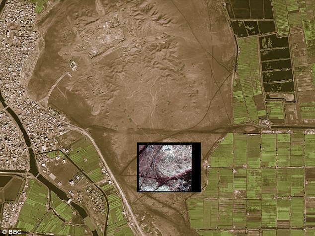
Modern city San El Hagar on the left, with the inset showing the location of ancient Tanis.
Whilst researching this page we came across a Google Earth image of the same area. This image might be held to give some hint of what was there, in the way of an underlying Tanis street map, to be more fully dicovered by space satellite archaeology.
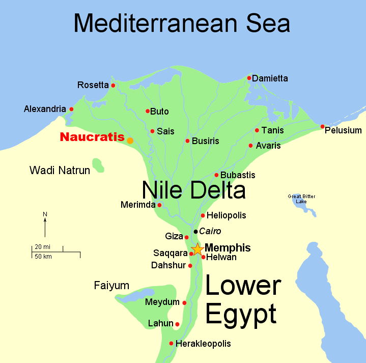
On a larger scale map Tanis appears north-east of Cairo, and in the Nile Delta.
To further test some of the most recent satellite remote-sensing finds, Parcak enlisted the help of a French archaeological team which already had a long history of digging at the 3000-year-old Tanis site. The satellite data revealed a warren of mud-brick walls, a maze-like street plan, and large residences that may have housed the wealthy. So the French team chose a structure from the images and excavated there. Beneath about 30 centimeters of sediments, they discovered mud brick walls.
According to Dr Sarah Parcak;-
"They found an almost 100% correlation between what we see on the imagery and what we see on the ground. They'd excavated a 3,000-year-old house that the satellite imagery had shown and the outline of the structure matched the satellite imagery almost perfectly. That was real validation of the technology."
"They found an almost 100% correlation between what we see on the imagery and what we see on the ground. They'd excavated a 3,000-year-old house that the satellite imagery had shown and the outline of the structure matched the satellite imagery almost perfectly. That was real validation of the technology."
Dr Sarak Parcak is considerably enthuisiastic about implications of the satellite facilitated discernment of the street map of ancient Tanis.
"This hints at the possibilities of discoveries to come, I am excited for my generation and the generations to come. There is enough to be excavated
for 50 generations to come."
Parcak worked with Zahi Hawass, Ph.D., Egypt's Minister of State for Antiquities, who was instrumental in her being allowed access to the excavation sites.
This is the first time Parcak has done a discovery on this a large a scale, she said. She also plans to partner with Hawass for training young Egyptians to do this work as well.
"It is important that we map out our ancient history before it's gone," she said.
A TED Presentation by Dr. Sarah Parcak